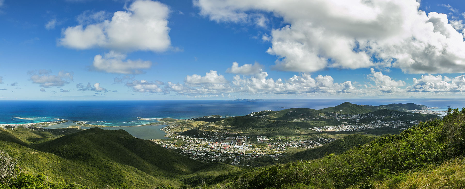
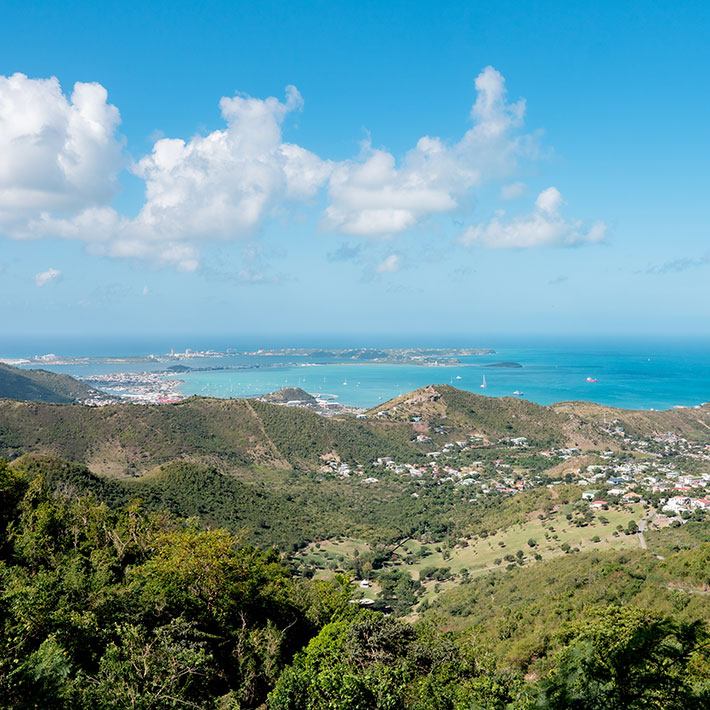
With an elevation of 1,391 ft, Pic Paradis is the highest point on Saint Martin. It offers a magnificent panoramic view over the entire island and the neighboring islets.
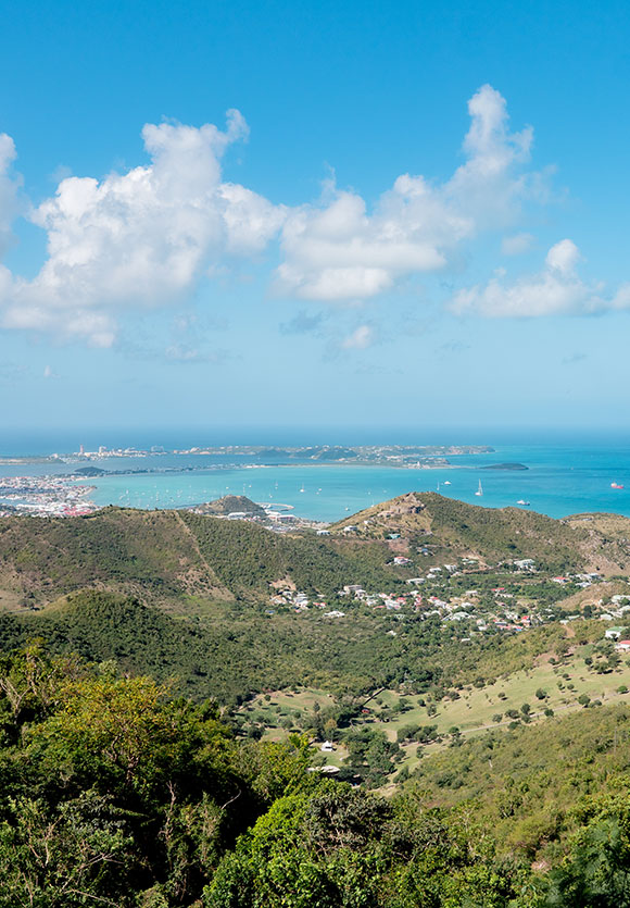
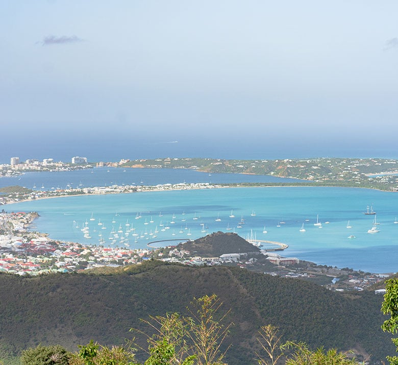
You can spot and identify the iconic sites of Saint Martin, like Marigot and Fort Louis to the west. Looking northwards, you’ll see the village of Grand Case, Creole Rock, and the jagged coastline of Happy Bay.
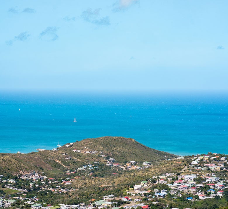
To the east, OrientBay, the fish pond and Lucas Bay appear to mingle in a blend of azure and turquoise. And to the west, Terres-Basses catches your eye. This area looks like it’s floating in the sea and includes Red Bay, Long Bay, and a beautiful luxury hotel, La Samanna. Toward the southwest, beyond Simpson Bay Lagoon, you only have to watch the planes on approach to spot the iconic district and beach of Maho. Directly south, the town of Philipsburg stretches before your eyes along with the entire Dutch part of the island. Seen from this exceptional angle, every beach on Saint Martin beckons you!
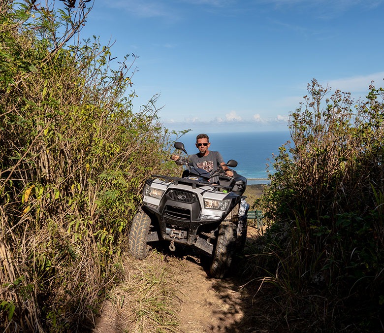
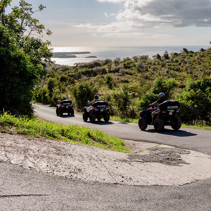
Nature lovers can walk to Pic Paradis to discover the luxuriant tropical vegetation and put their love of exercise to the test. The climb to the top from Loterie Farm will take between 45 minutes and an hour. You’ll need good hiking boots as it’s a very steep ascent, first on an asphalt road, then on craggy dirt tracks. You can also start the climb by car until the state of the road obliges you to park and finish on foot. As you approach the peak, the wooded terrain becomes increasingly dense and difficult to cross. The road yields to a track full of cracks, distortions and potholes, which is sometimes even obstructed by vegetation. Nature protects itself. This heavenly spot has to be earned! As a general rule, if you go by road, we recommend you take a fairly powerful vehicle, preferably a 4×4, considering the steep terrain. Otherwise, you run a considerable risk of damaging the car frame and wheels.
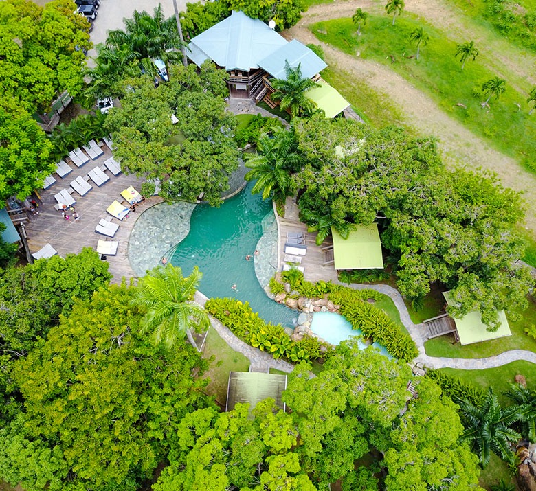
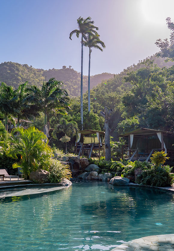
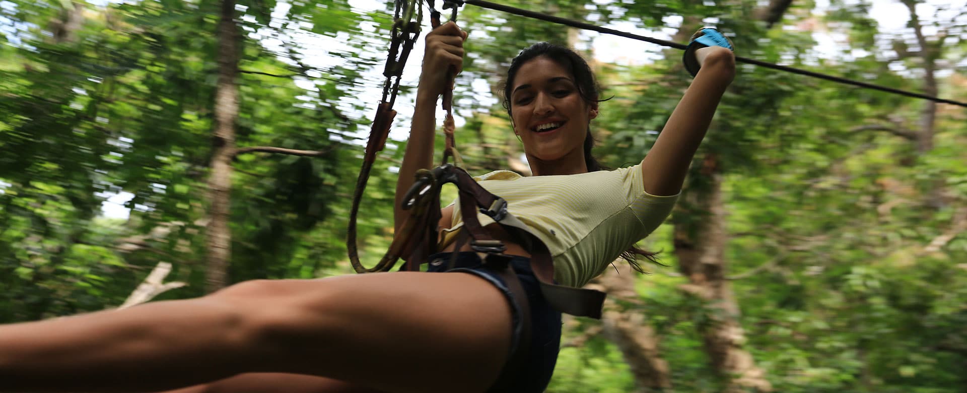
Loterie Farm, a green haven
Loterie Farm’s treetop adventure trails start on Pic Paradis. Exploring the tropical forest from tree to tree, between platforms and rope bridges, is an absolute must-do for anyone who wants to discover Pic Paradis’s habitat and ecosystem.
Built in 1773, Loterie Farm is a former sugar plantation that closed down in 1855. Nowadays, the smells, the ambient freshness and the sounds of nature at this site strike an amazing contrast with the rest of the island. Loterie Farm is one of nature’s sanctuaries, offering a blend of physical challenges, adrenaline thrills, enchantment, and the joys of swimming in a spring-water pool.
Hikers’ Paradise
A number of hiking trails also start at the island’s high point. You can follow them to the coast and the many beaches of Saint Martin. Your efforts will be well rewarded!
We suggest four itineraries for you to try, preferably with hiking boots. A compass will come in handy because the uneven terrain through the forest can mess up your sense of direction.
Northeast Ridges
Distance: 2.8 mi – Elevation drop: 1,345 ft – Starts at: Pic Paradis – Ends at: Orient Bay
From the island’s highest point, head north along a mountain path, and turn eastwards once you’re above the hill named Montagne France. Then continue through the forest, cutting across the ruins and tombs of the abandoned hamlet of Petit-Fond. Get back on the main path, head toward and cross the N7 road. The Orient Bay area is just ahead of you. You might want to continue to the beach for a swim in the sea.
Pic Paradis
Baie Orientale
Antenne du Pic Paradis
Mont des Accords
Central Ridges
Distance: 2.8 mi – Elevation drop: 508 ft – Starts at: Pic Paradis antenna -Ends at: Concordia Hill and St Peters Hill antenna
Head south from Pic Paradis. Beware, this hiking trail can become impassable in rainy weather. The path stays close to the ridge line, which you’ll follow down to Mount Flagstaff. You’ll then follow the border, a long stone wall running between the two parts of the island. Concordia Hill is on the French side and St Peters Hill is just opposite, on the Dutch side of the border.
Eden Well
Distance: 2.8 mi – Elevation drop: 1,345 ft – Starts at: Pic Paradis west antenna – Ends at: Pic Paradis
This loop trail follows a ravine on the north side of Pic Paradis. Take the main path toward the west and to the main road (Route du Pic Paradis), which you’ll follow for a short distance. You’ll pass in front of the ruins of the Paradis sugar plantation and a well with two large cast-iron kettles. The path then climbs toward the ridge and leads you back to the island’s highest point.
Antenne du Pic Paradis
Pic Paradis
Antenne du Pic Paradis
Plage de Happy Bay
Rambaud Ravine
Distance: 3.7 mi – Elevation drop: 1,312 ft – Starts at: Pic Paradis west antenna – Ends at: Happy Bay Beach.
The trail follows a ravine which you’ll find on the western side of Pic Paradis. Or you can simply go down the road that leads to Loterie Farm (Route du Pic Paradis). You’ll go past Loterie Farm and continue your descent to Rambaud. You’ll find Rambaud Ravine when you reach the Minguet Art Gallery. Head downhill toward Friar’s Bay (Anse des Pères). Then walk northwards along the coast to Happy Bay Beach, which is less than half a mile away, just after Mount Choisy.
FAQ
How high is Pic Paradis?
Pic Paradis culminates at 1,391 feet.
Is it possible to drive to Pic Paradis?
Yes, it can be reached by car, but you’ll have to walk the final section. Once you leave the Pic Paradis’s main asphalt road, it’s best to park and continue on foot. Only all wheel drive vehicles can negotiate this track.
How long does it take to climb Pic Paradis?
From the bottom of Loterie Farm, it takes 45 minutes to an hour to walk to the summit of Pic Paradis. It will depend on your level of fitness and how hot it is.
What hiking gear do we need?
We recommend suitable footwear, preferably hiking boots, to protect you from the vegetation and mud and to prevent you from spraining an ankle. Also, you should take a hat, sunscreen, and plenty of water to stay hydrated. Lastly, a compass will help you find your way, because the paths in their natural state sometimes reserve a few surprises. Markers and landmarks are scarce. In some places, the trail is covered by an abundance of vegetation.